


Scientists from the University of Panama’s Geosciences Institute are conducting field studies across the Azuero region to document earthquake ground changes following the recent seismic event, with preliminary estimates suggesting the fault rupture extends between 170 and 180 kilometers. The research teams are using drones and installing additional seismic stations to map surface deformations, landslides, and displacement patterns that will inform reconstruction planning.
Arkín Tapia, head of the Seismic Network at the Geosciences Institute, confirmed that specialists have divided into two groups to accelerate assessments. One team operates drones to gather geological and morphodynamic data while the other installs new seismic monitoring equipment throughout Azuero.
Earthquake Ground Changes and Fault Movement Analysis
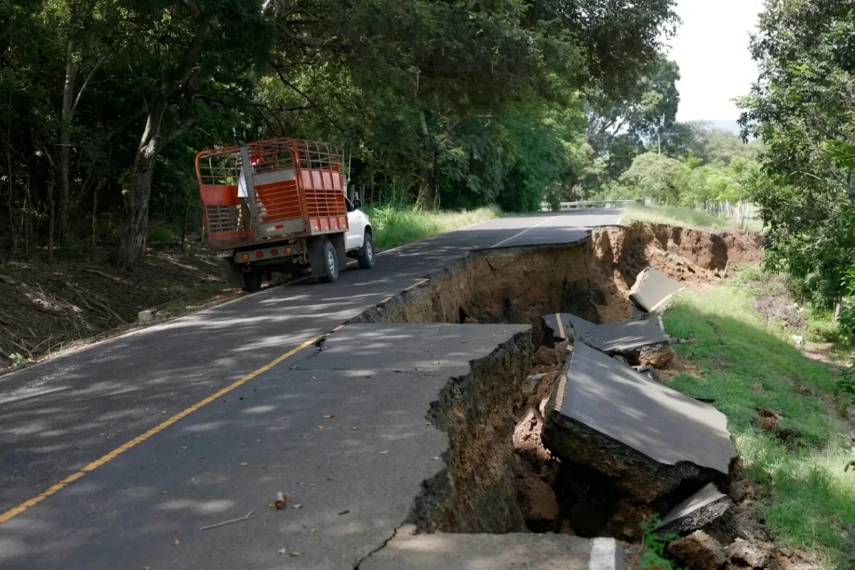
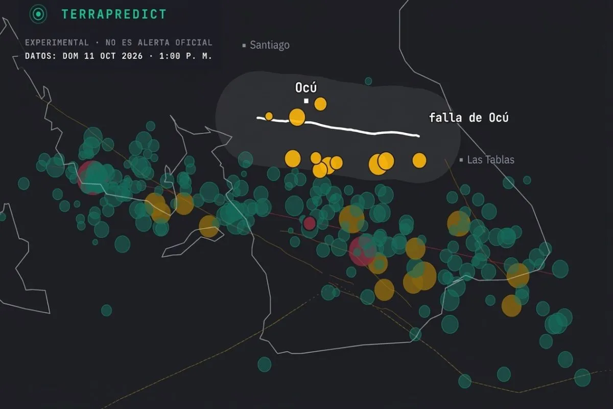
The fault responsible for the earthquake exhibits what geologists describe as oblique movement, combining both lateral and vertical components. This dual motion means some areas show uplifted or sunken terrain blocks, creating visible steps and surface changes across farms, roads, and mountainous zones. Tapia explained that the distribution of aftershocks allows researchers to estimate the rupture zone’s size, which preliminary data places between 170 and 180 kilometers.
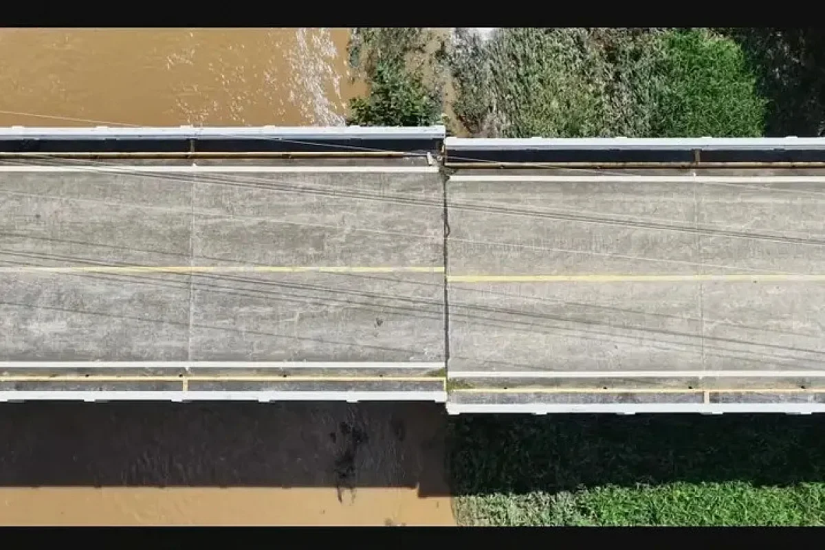
Documentation efforts focus on recording deformations observed in agricultural lands, highways, and elevated areas. The Oria River bridge serves as a key example, where lateral displacement occurred and now stands as direct evidence of fault movement. These observations will contribute to a detailed cartography of impacted areas, identifying fault locations and their implications for future infrastructure projects.
Seismic Network Expansion and Data Collection
The installation of additional seismic stations across Azuero aims to capture more comprehensive data on aftershocks and build a more complete seismic catalog. Tapia noted that if another significant event occurs, the instruments could provide critical information about ground acceleration, which would guide reconstruction decisions. This expanded monitoring capacity represents a significant upgrade to the region’s seismic observation infrastructure.
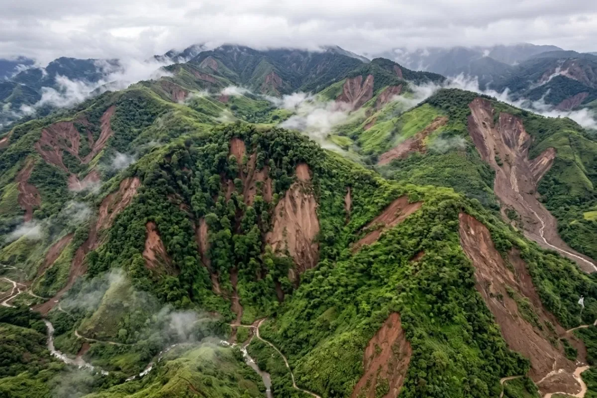
The field teams are also documenting hillside instabilities in mountainous areas of Azuero and other elevated points. Tapia explained that seismic wave amplification in higher terrain can intensify ground vibrations and trigger landslides. Specific locations under investigation include Cerro Los Picachos de Olá and La India Dormida in the Valle de Antón, where the energy released during the earthquake manifested in visible terrain changes.
Building Restrictions and Reconstruction Safety Guidelines
Tapia warned that some existing structures may sit directly on active faults or near geological features with displacement potential. Identifying safe zones for schools, hospitals, and other critical facilities has become a priority for the research teams. He cited Managua, Nicaragua as an example where authorities maintain fault zones free of construction because fault movement can deform and damage buildings even without generating an earthquake.
The collected scientific data will serve as input for authorities evaluating terrain conditions before defining reconstruction works. The comprehensive mapping of fault lines and surface deformation patterns will help determine where new infrastructure can be safely established and which areas require special engineering considerations or complete avoidance.
Regional Impact and Future Monitoring
The earthquake’s effects extend beyond immediate structural damage, with the documented ground changes reshaping the region’s geological understanding. The combination of drone surveys, instrumental data, and field observations will provide a complete picture of how the terrain responded to the seismic event. This information proves essential for long-term planning as communities rebuild and prepare for future seismic activity.
The Geosciences Institute’s ongoing work represents a critical step toward understanding the full scope of the earthquake’s impact on Azuero’s landscape. As field observations continue and instrumental data accumulates, researchers will refine their understanding of the fault system and its behavior, ultimately contributing to safer reconstruction practices and improved seismic resilience throughout the region.