


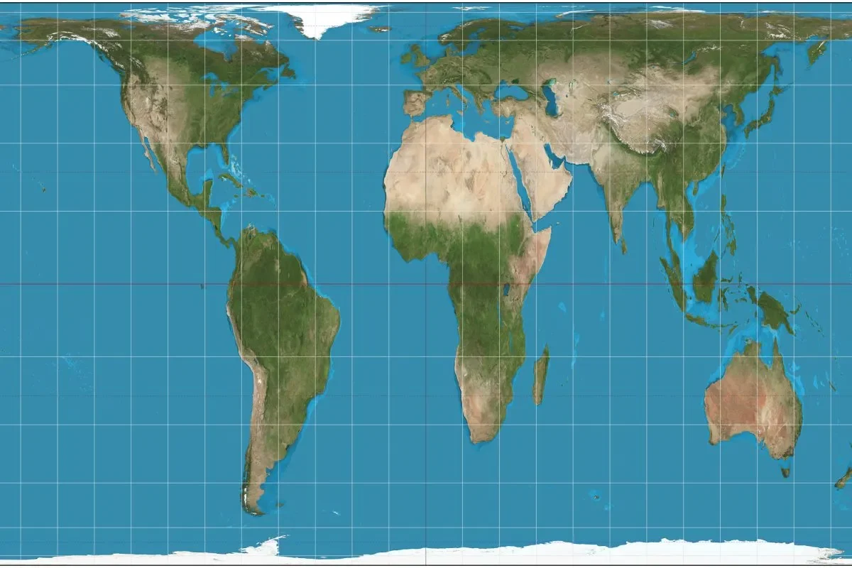
For generations, students in Panama City have stared at classroom walls where their slender isthmus appears as a modest ribbon connecting two massive continents. But that familiar image, shaped by a 16th-century navigation tool, has now faced a historic reckoning at the United Nations. The global body voted decisively to retire the Mercator projection as the standard “UN world map” reference, adopting instead the Equal Earth design that shows equatorial nations like Panama at their true, larger scale.
The 164-to-1 vote in New York signals a profound shift in how international institutions, schools, and technology platforms will represent the planet. While the resolution is non-binding, its symbolic weight carries enormous implications for Central American countries that have long seen their geographic importance visually diminished on traditional maps.
Panama’s Cartographic Legacy Under Mercator’s Distortion
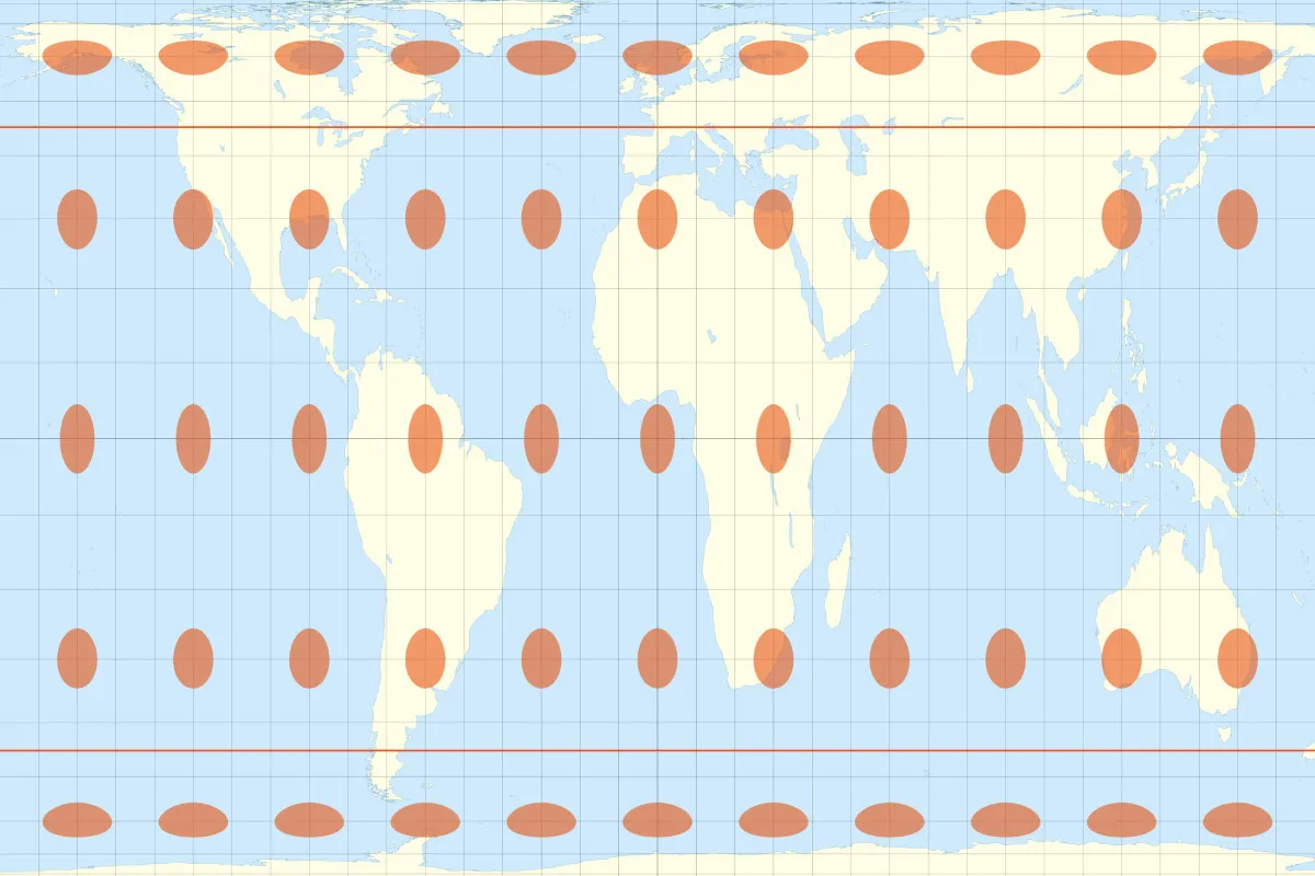
The Mercator projection, created by Flemish cartographer Gerardus Mercator in 1569, served sailors navigating the high seas for nearly five centuries. Its genius lay in preserving straight lines for maritime routes, which made it invaluable for European explorers charting courses to the Americas. But that practical advantage came with a steep visual cost for tropical regions.
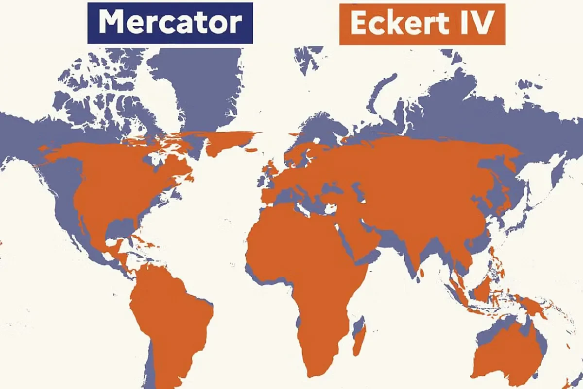
Countries near the equator, including Panama, Costa Rica, and Nicaragua, appear dramatically smaller than their actual land area. Meanwhile, nations in the northern hemisphere, such as Canada, Russia, and Greenland, balloon to oversized proportions. Greenland, for instance, looks comparable to Africa on a Mercator map, though the African continent is actually 14 times larger. This distortion has quietly shaped perceptions of Central America’s geopolitical significance for decades, making the isthmus seem like a minor player when in reality its strategic maritime position and canal infrastructure are outsized on the global stage.
The UN World Map Resolution and Equal Earth Alternative
Friday’s session at UN headquarters marked the culmination of a campaign led by Togo on behalf of the African Union, though its effects ripple far beyond that continent. The resolution formally endorsed the Equal Earth projection, developed in 2018 by an international team of cartographers using modern algorithms to maintain accurate area relationships across all latitudes.
Robert Dussey, Togo’s foreign affairs minister, framed the debate as one grounded in evidence rather than politics.
“This discussion is not a political discussion [but] a scientific discussion, because there is scientific proof so we all have to accept the reality.” [Translated from Spanish]
The vote saw only the United States oppose the measure, with its representative calling the resolution “superfluous.” Six nations abstained.
France moved swiftly to align with the new standard, with Foreign Minister Jean-Noël Barrot announcing that French institutions would adopt the Eckert IV projection, a close cousin to Equal Earth.
“[We] will abandon the Mercator projection in favour of map representations tailored to specific uses, more faithful to actual surface areas and in line with the recommendations of cartographers and scientists.” [Translated from Spanish]
Central America’s True Scale and Global Implications
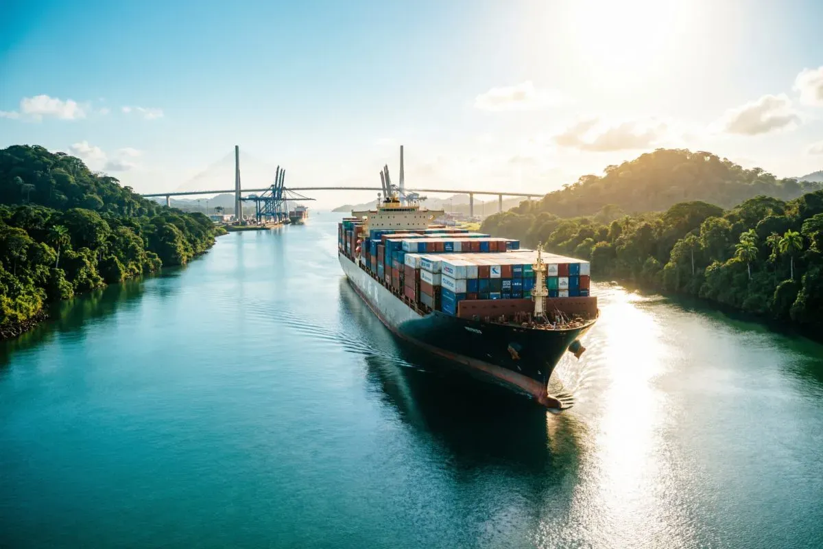
For Panama specifically, the shift could recalibrate how international partners view its role in global commerce and logistics. The Panama Canal already handles roughly 5% of world maritime trade, a figure that deserves visual representation matching its operational significance. Under Equal Earth, Panama’s territory appears wider and more substantial, reflecting its actual role as a bridge between hemispheres rather than a narrow afterthought.
Geographers and historians have long argued that the Mercator projection reinforced colonial-era hierarchies by inflating the visual presence of northern powers while shrinking equatorial regions. Some activists coined the term “cartographic colonialism” to describe this phenomenon. The distortion subtly influenced trade negotiations, development priorities, and educational frameworks across Latin America for generations, experts argue.
JJ Enoch, a London-based senior associate at geopolitical risk advisory firm JS Held, connected the campaign to broader demands from developing nations for fairer representation.
“Adopting an equal-area map would provide a more accurate basis for education and public understanding, while signalling that Africa’s demographic, economic and geopolitical importance should no longer be viewed through inherited and distorted conventions.” [Translated from Spanish]
The same logic applies with equal force to Central America’s emerging economies and strategic corridors.
Reactions and the Road Ahead for Cartographic Standards
Not everyone welcomed the change with enthusiasm. The lone American dissent echoed long-standing friction over UN efforts to standardize global knowledge systems. But supporters of the resolution point to a groundswell of public support, including a Change.org petition for the #CorrectTheMap campaign that gathered more than 11,000 signatures before the African Union endorsed it in August 2025.
Togo’s government is now planning an event in Lomé with UNESCO, the African Union, and technology brands to promote the new standard across educational platforms and digital mapping tools. For Panama and its Central American neighbors, the practical effects will unfold gradually as textbook publishers, software developers, and government agencies update their visual references. The 2018 Equal Earth projection offers a compromise between accuracy and aesthetics, avoiding the extreme shapes of earlier alternatives like the controversial Gall-Peters map from 1973.
The vote does not mandate immediate replacement of every Mercator map in every classroom, given the resolution’s non-binding nature. But the momentum suggests a generational shift is underway. Panama’s Ministry of Education has not yet announced specific curriculum changes, though regional education ministries across Latin America often follow UN recommendations in updating geography materials. Digital platforms like Google Maps and Apple Maps face no legal obligation, but public pressure and corporate social responsibility initiatives could accelerate voluntary adoption of the Equal Earth baseline.
Ultimately, this cartographic correction represents more than a technical adjustment. It acknowledges that how we draw the world shapes how we understand power, identity, and belonging. For Panama, a country whose entire national narrative revolves around connection, the new map finally shows the isthmus at a scale that matches its ambition.